5
Overview
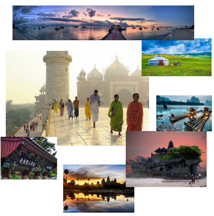
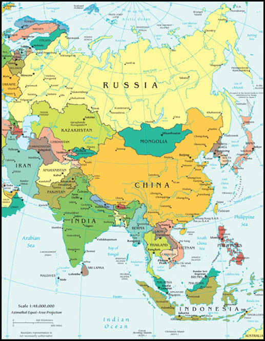
Of the world’s seven continents, Asia is the largest. Its physical landscapes, political units, and ethnic groups are both wide-ranging and many. Besides Russia, Southwest Asia, and Central Asia (different units), Asian regions include South Asia, East Asia, and Southeast Asia. Countries in the continent of Asia have gone through a seesaw of economic and political changes throughout the last century, and more specifically, since the end of World War II; a wide variety of types of government and also, transitioning at times from command economic systems to free market systems, have led to small and large scale conflicts. Tourism is a large import for the region, and will continue to be impactful as technological changes advance opportunities. Visitors to the region will want to pay close attention to numerous languages, religions, and conflicts.
South Asia extends south from the main part of the continent to the Indian Ocean. The principal boundaries of South Asia are the Indian Ocean, the Himalayas, and Afghanistan. The Arabian Sea borders Pakistan and India to the west, and the Bay of Bengal borders India and Bangladesh to the east. The western boundary is the desert region where Pakistan shares a border with Iran.
East Asia is a large expanse of territory with China as its largest country. The countries of Mongolia, North and South Korea, and Japan are also included in East Asia. The island of Taiwan, off the eastern coast of China, has an independent government that has been separated from mainland China since shortly after World War II.
The region between China, India, Australia, and the Pacific Ocean is known as Southeast Asia. Southeast Asia is a region of peninsulas and islands, and includes the fourth most populous country in the world, Indonesia. The only landlocked country is the rural and remote country of Laos, which borders China, Vietnam, and Thailand. Southeast Asia can be divided into two geographic regions – the mainland portion and the islands. The mainland portion, which is connected to India and China, extends south into what has been called the Indochina Peninsula or Indochina, a name given to the region by France. This mainland region consists of the countries of Vietnam, Laos, Cambodia, Thailand, and Myanmar (Burma). This region has been influenced historically by India and China. The islands or insular region to the south and east consist of nations surrounded by water. The countries in this region include Malaysia, Singapore, Brunei, Indonesia, East Timor, and the Philippines.
Map of Asia
Suggested Research Links for Asia
In this section you will find website links to additional resources to help enhance your research. Your research for your assignments are not limited to the resources that we provide. Please expand your research above and beyond this list.
CIA World Factbook
- https://www.cia.gov/library/publications/the-world-factbook/
- The World Factbook is a reference resource produced by the Central Intelligence Agency with almanac-style information about the countries of the world.
Lonely Planet – Asia
- https://www.lonelyplanet.com/asia
- Lonely planet is the largest travel travel guide book publisher in the world.
Nomadic Matt – Asia
- http://www.nomadicmatt.com/travel-guides/
- Nomadic Matt is a travel blog and website that was created by the author of the New York Times best-selling book, How to Travel the World on $50 a Day. This site expresses how to travel on a budget.
Rough Guides – Asia
- http://www.roughguides.com/destinations/asia/
- Rough guides is a “tell it like it is” travel guide with contemporary writing and up-to-date information.
Travel and Leisure Online
- http://www.travelandleisure.com/
- This travel site offers world news, travel tips, guides and information on the top destinations of the world. This resource also includes articles, videos, guides to lodging and restaurants.
Weather and Climate
- https://weather.com/
- Resource to local weather from around the world.
BBC Online
- http://www.bbc.co.uk/religion/religions/
- This resource offers a brief description of the major religions of the world.
Wandering Earl – Travel Blog
- http://wanderingearl.com/
- A personal travel blog that describes his adventures from traveling the world.
Eating Around the World
- http://globaltableadventure.com/
- Over 650+ food recipes from around the world!
Vagabrothers
- https://www.youtube.com/user/vagabrothers
- Two brothers travel around the world on a budget and create video blogs to explore the world and its people.
Travel Channel
- http://www.travelchannel.com/interests/travel-tips
- On this resources you will find tricks and tips on how to be a safe traveler. Topics include packing, lodging and transportation.