8
Overview
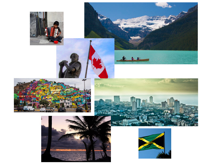
The realm of North America as a continent extends from the polar regions of the Arctic in northern Canada and Alaska all the way south through Mexico and the countries of Central America. Geographers usually study the continent by dividing it into two separate realms based on differences in physical and cultural geography. Both the United States and Canada share similar physical geography characteristics as well as a common development history with either a British or French colonial legacy. Mexico and Central America are dominated by more tropical climates and were colonized mainly by the Spanish. The United States and Canada—the second and third largest countries in the world in physical area, respectively—make up more than 13 percent of the world’s total landmass. The North American region is highly urbanized—about 80 percent of the population lives in cities—but other vast areas, especially in Canada, are sparsely populated. Although some natives remain, most of North America’s diverse population consists of immigrants or descendants of immigrants from other world regions.
Mexico has an extensive land border with the United States, its neighbor to the north. The Baja Peninsula borders California and the Pacific Ocean and extends southward from California for 775 miles. The Yucatán Peninsula borders Guatemala and Belize and extends north into the Gulf of Mexico. The Yucatán was a part of the ancient Mayan civilization and is still home to many Maya people.
The Caribbean, the geographic realm between the United States and the continent of South America, consists of three main regions: the Caribbean, Mexico, and the Central American republics. This class will include Central America in the earlier Latin America unit. The Caribbean region, the most culturally diverse of the three, consists of more than seven thousand islands that stretch from the Bahamas to Barbados. The four largest islands of the Caribbean are Cuba, Jamaica, Hispaniola, and Puerto Rico. Hispaniola is split between Haiti in the west and the Dominican Republic in the east.
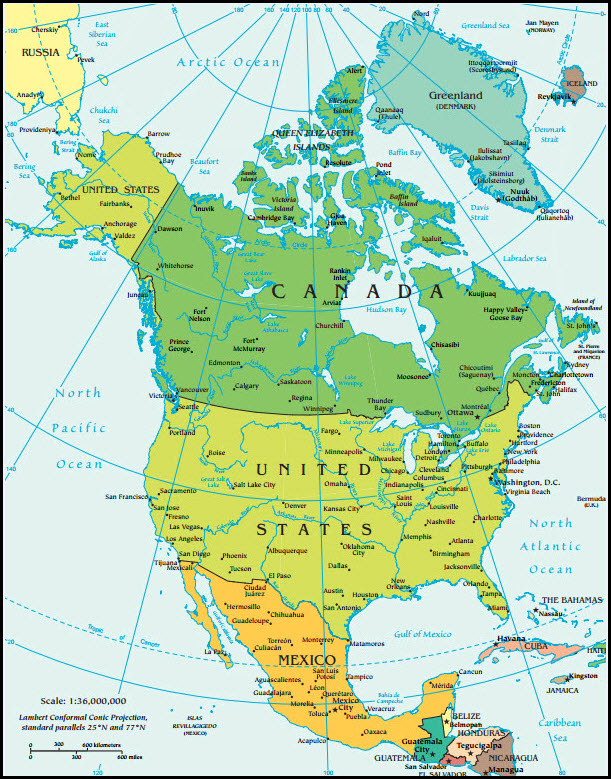
Map of North America
Suggested Research Links for North America
In this section you will find website links to additional resources to help enhance your research. Your research for your assignments are not limited to the resources that we provide. Please expand your research above and beyond this list.
CIA World Factbook
- https://www.cia.gov/library/publications/the-world-factbook/
- The World Factbook is a reference resource produced by the Central Intelligence Agency with almanac-style information about the countries of the world.
Lonely Planet – North America
- https://www.lonelyplanet.com/north-america
- Lonely planet is the largest travel travel guide book publisher in the world.
Nomadic Matt – North America
- http://www.nomadicmatt.com/travel-guides/
- Nomadic Matt is a travel blog and website that was created by the author of the New York Times best-selling book, How to Travel the World on $50 a Day. Expresses how to travel on a budget.
Rough Guides – North America
- http://www.roughguides.com/destinations/north-america/
- Rough guides is a “tell it like it is” travel guide with contemporary writing and up-to-date information.
Travel and Leisure Online
- http://www.travelandleisure.com/
- This travel site offers world news, travel tips, guides and information on the top destinations of the world. This resource also includes articles, videos, guides to lodging and restaurants.
Weather and Climate
- https://weather.com/
- Resource to local weather from around the world.
BBC Online
- http://www.bbc.co.uk/religion/religions/
- This resource offers a brief description of the major religions of the world.
Wandering Earl – Travel Blog
- http://wanderingearl.com/
- A personal travel blog that describes his adventures from traveling the world.
Eating Around the World