10 Toward an Inclusive Geospatial Community
An Interview with Steven Ramage
Steven Ramage and Diana Mastracci Sánchez
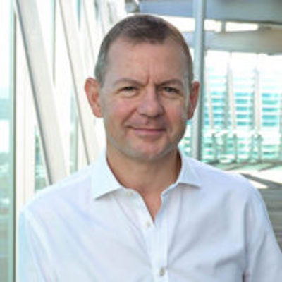
The following is an interview conducted by Diana Mastracci Sánchez with Steven Ramage, CEO and Founder of Réseau Consulting.
From your perspective, why is it crucial to have an Indigenous-led alliance advocating for access to Earth observation data for and by Indigenous Peoples? How does the Alliance uniquely contribute to addressing the needs and concerns of Indigenous communities?
My experience working with Indigenous communities is only several years old, however I have been working with multiple different communities for decades.
I know that to work with communities you need to either have firsthand experience or a deep understanding of local practices – customs and traditions. It has been obvious to me that even people who mean well are not fully aware of the needs and wants of Indigenous Peoples, therefore it is crucial to have an Indigenous-led alliance, with others who understand and who empathise in contributing but not leading. In this way such an Alliance doesn’t have to assume or guess those needs and wants.
The Alliance can also represent the various Indigenous communities from around the world that are also different in their local customs and needs.
As an expert in the geospatial domain, how would you describe the role of Earth observation data in understanding and addressing the challenges of climate change? How can this data contribute to climate change adaptation and mitigation strategies?
My knowledge around climate change adaptation and mitigation is mainly linked to the Paris Agreement and attendance at the UNFCCC climate conference of the parties – the COPs. Through the official process I have watched countries (since 2015) discuss the value and usefulness of Earth observations in these areas, particularly through the work of WMO, CEOS, GEO and others. It was only more recently that I am aware that Indigenous communities were invited to the technical meetings. I have also been part of Green Climate Fund (GCF) and Global Environment Facility (GEF) activities, where I know the former has an Indigenous Peoples policy and GEF has been working with Indigenous communities since 1991 with principles and guidelines for engagement and a GEF Indigenous Peoples Advisory Group.
The applications for EO data in comprehending and tackling these challenges is broad, but it should be noted that we need more than EO data, for example population statistics and related socioeconomic data. At the same time as knowing more about the people who live in the area and their situation, the same is true for nature, we need to know and understand more about ecosystems and protect them. In many cases, the Indigenous community has longstanding good practices around nature that are being ignored or destroyed.
EO is used to monitor changes in:
- Earth’s global and regional temperatures
- Sea level to assess the impact of climate change on coastal communities
- The size and volume of ice sheets and glaciers
- Vegetation cover and ecosystems
- Deforestation and other land use changes
- Urban sprawl and the associated impacts
These are just some examples where we could go much deeper into these areas and others to assess what must be done for climate mitigation and adaptation. For example, with deforestation it has been decades of abuse. It does not seem possible to stop activities completely, so instead we have to hope that schemes, such as payment for ecosystem services, can compensate the appropriate parties for maintaining or restoring forests. At the same time, if we can blend EO data with other data sources and map vulnerable communities at risk from the negative impacts of climate change, e.g. flood and drought or increased severity of wildfires, then this should help develop adaptation strategies, such as building seawalls and reservoirs. I know the GEO Indigenous Alliance has worked to bring together traditional knowledge with state-of-the-art EO science and technology, and I think more is needed.
From your perspective, what advancements and innovations in Earth observation technology are expected to drive progress in climate action over the next decade, and how can the GEO Indigenous Alliance leverage these developments to support Indigenous communities’ climate resilience efforts?
There are changes already taking place with synthetic aperture radar (SAR) and hyperspectral data that can help us with climate action by ‘seeing’ things differently from space. There are also more and more initiatives around the use of drones for mapping and monitoring smaller geographic areas, so there is no shortage of technology advancements. However, the improvements in technology and innovation are only tools to help provide insights and evidence, it’s changes in policies and processes based on those data that will help people and climate change resilience efforts.
We have all seen the impact on food security as agricultural supplies stopped leaving Ukraine, we have seen plagues of locusts in Africa, as well as flood and drought around the world. Using EO to track changes in agricultural yields and associated policies for crop diversification and irrigation will be important. Similarly with monitoring water resources, in terms of water quality, water conservation and drought-resistant crops. There are currently big ideas around early warning systems and early action plans, it’s not clear to me how inclusive these activities are, so engaging with these developments (underpinned by technology) could support Indigenous community resilience efforts.
Could you tell us more about your current efforts in developing a network of Réseau Associates, particularly focusing on young women geospatial practitioners from Africa, Asia, and Latin America?
Réseau aims to amplify the voices of young professional women from Africa, Asia, and Latin America (often referred to as the Global South), who face unique intersectional challenges related to race, ethnicity, religion, and socioeconomic status. By highlighting their perspectives, we seek to draw attention to these issues and promote a more inclusive worldview. This approach also aims to increase the visibility and representation of these women in leadership positions and international conversations in the geospatial arena. We believe that diverse teams generate innovative ideas, and we plan to collaborate with existing community groups to ensure a balanced approach. It’s important to say that this is complementary to existing initiatives that are sometimes global in nature or focused on a region, such as Women in Geospatial, Ladies of Landsat, Sisters of SAR, Women in Copernicus etc.
There were a couple things that motivated the development of the Reseau Associates. Firstly, after mentoring scores of younger professional women working in geospatial from around the world, there was a common complaint about not being listened to or taken seriously, these young women wanted a platform to express themselves and share their insights and ideas. Secondly, it was my experience that many people from international organisations would make bold statements at global events about supporting local communities, women from the global south etc. and nothing ever seemed to transpire, it just seemed like lip service, so I actually wanted to take action.
The Réseau Associates are predominantly women who are originally from the global south or are currently based there, with a number of other women and men (as allies) who are dedicated to supporting efforts in the global south. We do not empower, we facilitate south-south networking, we provide mentoring opportunities, we also offer an opportunity for all Associates to share their ideas via our website and the Voices blog, and over time we will work on science, technology, policy and research topics, hopefully with some stipends available for the Associates to get paid for their contributions.
For those who are interested, there is a Terms of Reference that was written, reviewed and agreed by the initial group of Associates. The number of Associates has now reached double figures and the plan is to keep supporting women practitioners who are interested in contributing via this approach. The main thing is that they want to make a difference and help use geospatial data, tools and services to tackle major global challenges around nature and climate, i.e. tackling the triple planetary crisis[1].
Looking to the future, how do you envision the legacy of the GEO Indigenous Alliance? What long-term impact do you hope the Alliance will have on the geospatial industry and Indigenous communities worldwide?
I was privileged to be involved in the GEO Indigenous Summit which produced fantastic knowledge sharing and an incredibly useful summary of the sessions. With over 1000 participants, I believe there’s a lot more to be done with the discussion topics. I still hear a lot about FAIR approaches but not much about TRUST and CARE and other frameworks relevant for Indigenous communities. Similarly with the hackathons. Bringing people together from around the world and actually taking action is massively important. The hackathons produce ideas, but more important collaborations and applications. It would be great to see more work on hackathons around climate adaptation and mitigation with some increased funding to grow the scale of activities. By building on these areas we will necessarily include the geospatial community and hopefully increase their awareness and knowledge about Indigenous communities around the world.
The legacy for me has to be one of collaboration and partnership where the GEO Indigenous Alliance is first and foremost supporting the needs of Indigenous communities and is also plugged into the UN Declaration of Indigenous People (UNDRIP) and other instruments that strive to support the rights of Indigenous communities around the world. If closer links can also be made, for example to GEO Flagships, then this will also be a strong legacy.
- Triple Planetary Crises is a terminology and framework adopted by the United Nations system to describe the three intersecting and global environmental crises of: Pollution. Climate crisis. Biodiversity loss and/or Ecological crises. ↵


