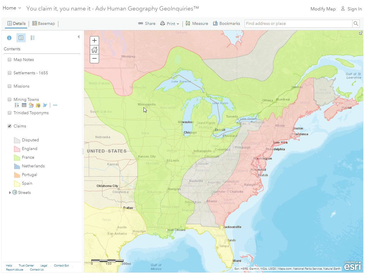
Step 1: Go to the ArcGIS Online map, You Claim It, You Name It, and explore the map.
Step 2: Open and read the map note located inside North America (in North Dakota).
- Who was North America named after?
Step 3: Open and read the map note located off the west coast of North America.
What is the toponymy of the East Coast?
Step 4: Click the button, Bookmarks. Select the Eastern Canada bookmark.
- Which languages were used for place names? (Hint: turn on the Claims layer.)
Language, another cultural trait, also influenced these place names.
Step 5: Click the button, Bookmarks. Select East Coast.
Step 6: Turn off the layer, Claims.
Step 7: With the Details button underlined, click the button, Show Contents of Map (Content).
Step 8: Click the checkbox to the left of the layer name, Settlements – 1655.
Step 9: Click on Show Map Legend for the layer name, Settlements – 1655.
- Where were the French settlements concentrated?
- Where were the English settlements?
What major migrations helped define California toponyms
Step 9: Click the button, Bookmarks. Select California-Local.
- Which languages were used for place names? Hint: Use the Claims layer again.
Step 10: Turn off the Claims layer, and turn on the layer, Missions. The Spanish built the missions for religious reasons.
- What spatial patterns do you notice?
Step 11: Click the button, Bookmarks. Select California-Regional.
Step 12: Keep the Missions layer on, and turn on the layer, Mining Towns.
- How were missions and mining settlements distributed?
How does Trinidad’s toponymy compare to Canada and California?
Step 13: Click the button, Bookmarks. Select the West Indies bookmark.
Step 14: Open and read the map note near Cuba.
The reason why the area is called the West Indies is that Christopher Columbus thought he was in Asia.
Step 15: Click the button, Bookmarks. Select the Trinidad bookmark.
Step 16: Turn on the layer, Trinidad Toponyms. Click the layer name to display its legend.
- What were the dominant languages used for Trinidad’s place names? Hint: look at the map legend.
The reason for so many languages in the region is because Trinidad was a contested land, switching between influential countries multiple times.
What is the relationship between colonization and toponyms?
Step 17: Click the button, Bookmarks. Select the European Claims bookmark.
Step 18: Turn on the layer, Claims. Click the layer name to display the legend.
- How are regional place names in the Americas tied to colonization?
- Besides toponyms, colonization and these early claims affect religion, language, architecture, and more. True/False
