What was the extent of Russia in the 1500s?
Step 1: Go to the ArcGIS Online map, Russia Expansion to the Sea. Take a moment to analyze the map.
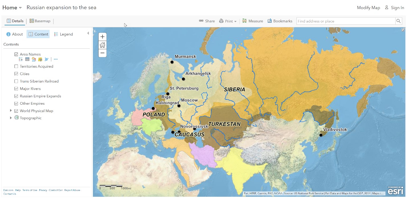
- Which physical features defined Russian territory in 1533?
- Using the Measure tool, determine the west-east distance of Russia in 1533.
- In what direction did Russia expand by 1598?
Why did Russia expand east?
- By what year did Russia reach the Pacific Ocean?
- What was the west-east distance of the Russian Empire by 1689?
- Why does the line curve when measuring?
Step 2: With the Details button depressed, click the button, Contents.
Step 3: Click the checkbox to the left of the layer name, Territories Acquired.
Step 4: Click Pop-up #1.
- Why was the fur trade a motive for expansion?
What challenges did Russia’s quest for a warm-water port meet?
Step 5: Turn on the Cities layer and pan west so that you can see both Canada and Russia.
- What ports in Russia would you expect to be ice-free in winter?
- A disadvantage of not having nice-free ports is that trade by sea could not occur year-round.
When and where did Russia expand west?
Peter the Great wanted to claim St. Petersburg to increase trade with Europe.
Step 6: Click Pop-up #3.
In 1703, Peter the Great acquired St. Petersburg after the war with Sweden. Later, St. Petersburg was called the “Window to the West” because it faced Europe.
- Using the Measure tool, measure the extent of the Russian Empire by 1796.
What geographic features impeded Russia’s southward expansion in the 1800s?
In addition to warm-water ports, Russia sought lands in areas with milder climates more suitable for agriculture.
Step 7: Turn off the Other Empires layer.
- Which empires do you think was most likely to prevent Russia from acquiring ports on the Black Sea?
Step 8: Click Pop-up #4.
- A significant result of the Crimean War is that Russia won and kept the Black Sea ports. (T/F)
- Into what other areas did the Russian Empire expand by 1914?
