What does Berlin have to do with Africa?
Step 1: Before 1870, Europeans had only claimed 10 percent of the land in Africa. Go to the ArcGIS Online Map, Africa’s Bounty, and Borders, and explore the map.
Step 2: Click the map note in Germany and analyze the political cartoon.
- How many pieces of “cake” are shown?
- What country is represented by the man with the knife?
- What do you think he wants?
Why Africa?
Step 3: Click the button, Bookmarks. Select Africa.
Step 4: With the Details button depressed, click the button, Contents.
Step 5: Click the checkbox to the left of the layer name, Minerals in Africa.
Step 6: Click the layer name to display the legend. Ferrous minerals contain iron, an essential material in making steel.
- What types of resources are found within Africa?
There is a large variety of minerals distributed throughout the continent of Africa. The Europeans wanted to colonize and control Africa’s natural resources to support industrialization.
How did the Europeans Divide Africa?
Step 7: Turn off the layer, Minerals in Africa.
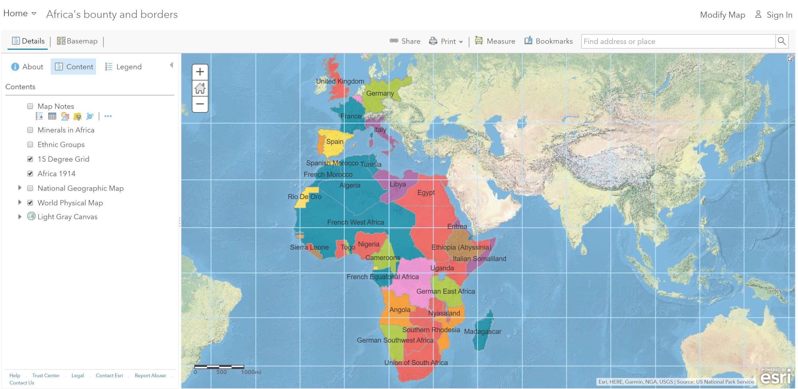
Step 8: Click the Africa 1914 layer name to open the legend.
Step 9: Use the legend, and then click the independent countries.
- Which two African countries were independent in 1914?
- Which two European countries controlled the most land in Africa?
Step 10: Turn on the Ethnic Groups layer.
- Do you think the Europeans considered ethnicity when dividing up Africa?
How did competition among the Europeans influence borders in Africa?
Step 11: Turn off the two layers, Ethnic Groups and Africa 1914.
Step 12: Turn on the National Geographic layer. Analyze the unusual shapes many of the nations have.
Step 13: Open and read the map notes on Namibia, Cabinda, and Gambia.
- Namibia’s shape was determined in a way so that Germany could reach the Indian Ocean via the Zambezi River. (T/F)
- The British resisted French efforts to acquire Gambia so that they could retain access to the river.
It should be noted that Angola was split into two parts to provide access to the Congo River.
How does the legacy of European-imposed borders affect Africa today?
Step 14: Switch between the Africa 1914 and National Geographic layers.
- How many African countries are landlocked?
- How do you think to be landlocked influences trade?
- How could borders affect political stability?
