What is deforestation?
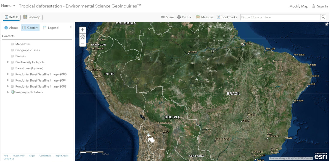
Step 1: Go to the ArcGIS Online map, Tropical Deforestation, and explore the map.
- The squares and patches within Brazil represent fragmented forests and areas of deforestation. (T/F)
Step 2: Click the left yellow marker to display a pop-up window. Click the image in the window.
- What do the colors represent?
- What is the relationship between the original green image and the red image?
How has tropical forest cover changed over time?
Step 3: With the Details pane visible, click the button, Contents.
Step 4: Click the checkbox to the left of the layer name, Forest Loss (by year).
- When generalizing about forest loss by year, dating from 2001 to 2014, it appears that deforestation has slowed since 2010, with most taking place in the early 2000s. (T/F)
What are some causes and effects of deforestation?
- What are some possible causes of deforestation?
- What are some possible effects of deforestation?
- Using the evidence provided from the map layer, what is a possible outcome – positive or negative – of increased deforestation?
Where is deforestation most severe today?
Step 5: Click the check-boxes (on and off) to the left of the three layers named, Rondonia Fragmentation, Brazil Satellite Image 2000, 2004, or 2008.
Step 6: Record notes of the patterns that you observe from the satellite images over time.
- What are some possible causes of these patterns?
- What are some possible methods of deforestation? What evidence can you gather from the satellite images?
- How much land has been consumed by deforestation? Using the 2008 Rondonia image, measure a rough estimate of the deforested area.
https://www.youtube.com/watch?time_continue=62&v=OCRFSrHKYoc
Recently, there has been concern about the amount of deforestation that is occurring in Indonesia to grow palm oil. The oil is now the most widely used vegetable oil in the world and is used for a variety of products that can be found at the supermarket. But because of its rapid growth, it is threatening the rainforests, biodiversity, and sensitive habitats throughout the planet.
Why should we care about deforestation?
- What are some ecological advantages provided by established, mature tropical forests?
Step 7: Click the check-box to the left of the layer name, Biomes.
- Describe the locations that you feel demonstrate the greatest number of species over a given region.
Step 8: Click the check-box to the left of the layer name, Biodiversity Hotspots.
- Describe the locations that you feel demonstrate the most significant number of species over a given region.
- What are some possible benefits of biodiversity?
