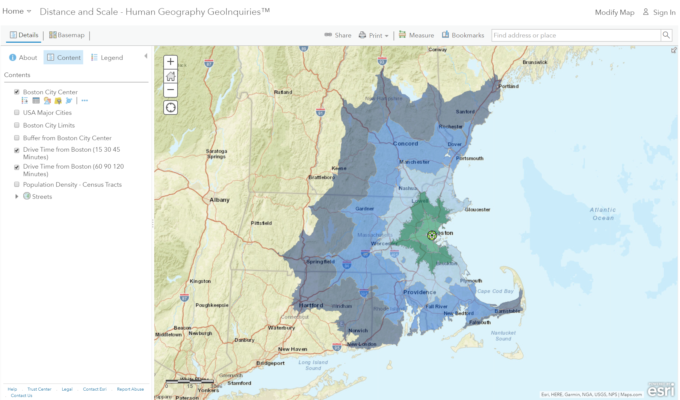
Ask: Are all miles “equally” distant?
Step 1: Go to the ArcGIS Online map, Distance and Scale, above to launch the map.
Distances can feel more substantial or smaller because of cultural similarities, transportation connectivity, telecommunications, and more.
Acquire: How far can you get?
Step 2: With the Details button underlined, click the button, Show Contents of Map (Content).
Step 3: Check the box to the left of the layer name, Drive Time From Boston (60, 90, 120 minutes).
- Q: Which major city in New Hampshire can you reach in less than an hour?
- Q: How long would it take to get to Providence, R.I.?
Explore: Are we taking the long way around?
Both Manchester and Worchester are at the outer edge of the 60-minute drive time zone. However, as the crow flies, it is 38 miles to Worchester and 48 miles to Manchester.
- Q: What city is located less than 50 miles from Boston (as the crow flies), but cannot be accessed in a 120-minute commute? Hint: water contributes to the time.
- Q: The travel time is so long because you have to drive around Cape Cod Bay. (T/F)
The other forms of transportation, such as water and air travel, might change travel time and accessibility.
Analyze: How is population density related to travel time?
Step 4: Click the button, Bookmarks. Select BOS-MHT/WOR.
Step 5: Turn on the layer, Population Density – Census Tracts.
Step 6: Compare the Population Density and Drive Time layers by turning them on and off.
- Q: What is the relationship between the drive time and population density?
Act: How do highways affect travel time?
Step 7: Turn off the layers, Drive Time from Boston (xx xx xx Minutes).
Step 8: Change the transparency of the Population Density – Census Tracts layers to 50 percent.
From the Details pane, click the Content button. Click the three small blue dots and hover your pointer over the word “Transparency” to open a drop-down list. You can modify the transparency to see an active layer below the top layer. Set it to 50 percent.
Step 9: Click the button, Bookmarks. Select Traffic.
- Q: How are major roads and population distributions related?
- Q: Travel is faster through more densely populated regions than less densely populated areas because of the high-volume transportation networks that are most commonly found there. Access to major roads, even if they are congested, enables faster commutes.
