Ask: where are the world’s agricultural lands located?
Step 1: Go to the ArcGIS Online map, Farming and the Rural Landscape, and explore the map.
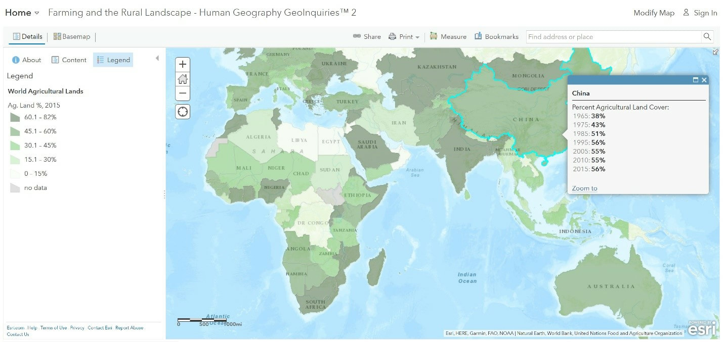
Step 2: Click on a country and reveal its pop-up.
- Using the World Agricultural Lands legend, which countries have over 60 percent arable land?
- Which country’s data are surprising?
- How does Saudi Arabia increase its agricultural land?
- Which large countries have under 15 percent arable land?
- Why do Russia and Canada have low percentages?
Acquire: where are agricultural lands in the united states?
- What is the percent of agricultural land in the United States?
- How has that percentage changed over time?
Step 3: With the Details button underlined, click the button, Show Contents of Map (Content).
Step 4: Check the box to the left of the layer name, USA Land Cover (2011). Click the layer’s name to see the legend.
Step 5: Uncheck the layer, World Agricultural Lands.
- Which colors indicate farming?
Step 6: Click the button, Bookmarks. Select, United States.
- Where are large areas of farms located?
Explore: how do rural landscapes within the united states differ?
Step 7: Click the button, Basemap. Select, Imagery.
Step 8: Turn off the layer, USA Land Cover (2011).
Step 9: Click the button, Bookmarks. Select, Kansas.
- What patterns do you observe?
Step 10: Toggle between the land cover and image layers.
- Does the land cover map confirm agricultural land use?
Step 11: Click the button, Bookmarks. Select, Louisiana.
- Do you observe croplands that are long, rectangular shaped?
Analyze: how does land use differ between rural and urban areas?
Step 12: The Great Dismal Swamp National Wildlife Refuge protects 112,000 acres of forested wetlands. Click the button, Bookmarks. Select, Dismal Swamp 1.
- The layer shows a lake in the middle and large, green areas surrounded by patches of farms.
Step 13: Click the button, Bookmarks. Select, Dismal Swamp 2.
Step 14: Zoom and pan the map.
- What do you see?
Step 15: Click the button, Bookmarks. Select, Chesapeake.
- The bookmark shows urban settlements bordering rural areas.
Act: how has human action affected rural areas?
- How has irrigation affected rural areas?
- What are some possible negative effects of the expansion of agriculture?
- How are cities changing rural areas?
