What characteristics define a city?
Step 1: Go to the ArcGIS Online map, Megacities, and explore the map.
- Provide three spatial observations you can see from the map. What spatial patterns do you observe?
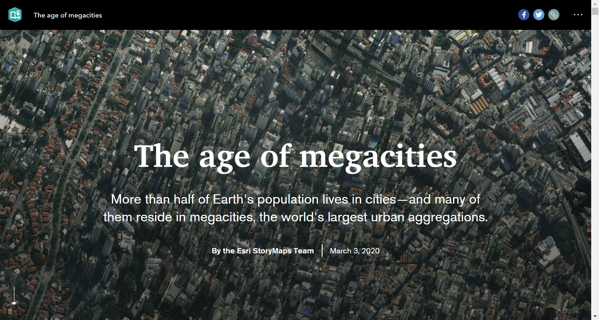
Cities include businesses, population, and cultural landscapes; urban areas also include non-rural regions, cities, and suburbs. A megacity is defined as a city that has a population higher than 10 million people.
What are some examples of megacities?
Some essential characteristics of a megacity include a dense population center, a large surface footprint, and an extensive transportation system.
Step 2: Using the Details pane, click the button, Show Contents of Map.
Step 3: Click the checkbox to the left of the layer name, World Urban Sprawl.
Step 4: Zoom out to the world view. The reason why some layers are not visible on the map is that the layer is set to be visible at a specific scale.
Step 5: Zoom in and out to view and explore some of these cities.
- What cities around the world might be megacities?
What factors influence urban center geography?
- What might be some factors leading to an increase in urbanization?
Step 6: Click the checkbox to the left of the layer name, Megacities.
- Where are most megacities located?
Step 7: Hover over the Megacities layer name and click the button, Show Table.
Step 8: In the table, click the column header, % Growth. Sort ascending.
- Which cities are growing the fastest?
Step 9: Investigate three cities by clicking their map markers.
Go to the story map, The Age of Megacities, and explore the maps and information provided.
How have cities changed over time?
- What are some possible factors leading to urban sprawl?
Step 10: Click the button, Show Map Contents.
Step 11: Turn off the layer, World Urban Sprawl.
Step 12: Turn on three layers, Tokyo 1929, Tokyo 1954, and Tokyo 1972.
Step 13: Toggle between the three years. Observe how Tokyo has changed over time.
Step 14: Click the button, Measure. Calculate the square kilometer footprint of urban growth for Tokyo 1929. Position the area of interest on the map so that the Measure window does not obscure it. Click the button, Measure. Select the Area button and choose a unit of measurement. On the map, click once to start the measurement, click again to change direction, and double-click to stop measuring.
What is wrong with sprawl?
Step 15: Repeat the measuring step for the remaining two years (1954, 1972).
- What is the square kilometer footprint for each year?
- What patterns of growth do you notice?
- What are some potential adverse effects related to urban sprawl?
