Why are boundaries important?
Step 1: To go the ArcGIS Online map, Borders, Boundaries, and Barriers, and explore the map.
Step 2: Zoom and pan the map to see the entire world.
- Political boundaries exist to divide the land and establish territory. What types of boundaries are on the earth?
What are the examples of the different types of boundaries on the earth?
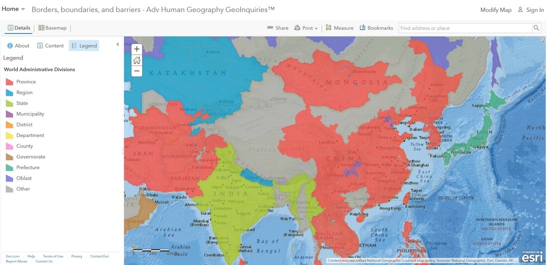
Step 3: With the Details button underlined, click the button, Show Contents of Map (Content).
Step 4: Check the box to the left of the layer name, World Administrative Divisions.
Step 5: Zoom in to the continent of Europe.
- What types of boundaries can be seen?
Step 6: Click a few administrative units to view the data.
Step 7: Hover the mouse over the layer name, World Administrative Divisions. Click the three dots and select the option, Transparency. Set the transparency of the layer to 50 percent.
- Where do you see geometric boundaries?
- Where do you see physical boundaries?
Are borders just boundaries?
- Disputed boundaries are often shown with dotted lines or notes on the map itself. On which boundaries do countries disagree?
Step 8: Filter the data in the World Administrative Divisions layer.
Step 9: Build the following query from the drop-down lists: Disputed Is 1. Ensure that Unique is chosen for the third drop-down list.
Step 10: Click Apply Filter. If results do not appear, ensure that the map is zoomed in enough that the layer name appears in the dark text.
- What changed on the map?
- Most disputed boundaries occur because of political and social instability, territorial disputes, and natural resource disputes. Where are most of the disputed boundaries of the world located?
Step 11: Turn off the layer, World Administrative Divisions.
What other types of boundaries exist on the earth?
Step 12: Click the button, Basemap. Select the basemap, Imagery with Labels.
Step 13: Click the button, Bookmark. Select the Great Wall of China.
- What barrier do you see? This barrier was used to slow invading northern armies.
Step 14: Click the Republic of Chile bookmark.
- What type of border can be found here?
Step 15: Observe the border of Chile with Peru, Bolivia, and Argentina.
- What are the advantages and disadvantages of this border?
Step 16: Click the North and South Korea bookmark.
- What type of boundary is between these two countries?
https://www.youtube.com/watch?v=4VfPRga_Kio
How can borders change?
Step 17: Investigate the boundary of Western Sahara and Morocco. If Morocco controlled the region, conflict from the increased territory would occur.
- What natural, cultural, or political factors can affect boundaries.
- How have trade and globalization affected the borders and boundaries of countries around the world?
