Why was Constantinople important?
Step 1: Go to the ArcGIS Online map, The Crusades. Take a moment and explore the map.
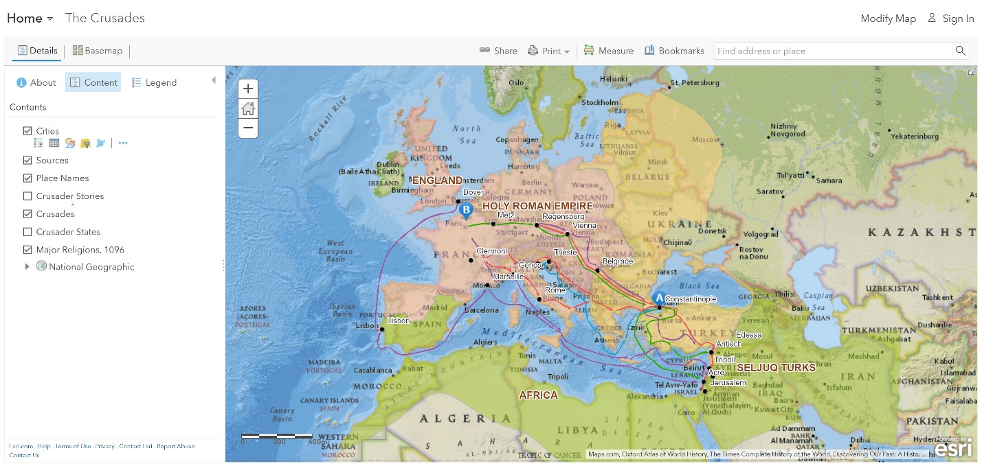
Step 2: Click Bookmarks, and choose Constantinople.
Constantinople is a strategic location because it is a crossroads of Europe and Asia, along with access to the Black Sea.
Step 3: Click Marker A.
- Why did Alexius write a letter?
Where were the Crusades, and why did they take place?
Step 4: Click the button, Bookmarks. Select Europe, Middle Ages. Click the reader Marker B.
- Why did Pope Urban call for a Crusade?
- Where did the Crusades originate?
- What was the destination of the Crusades?
Step 5: With the Details button depressed, click the button, Contents.
Step 6: Click the checkbox to the left of the layer name, Crusader Stories.
Step 7: Click each symbol and read the statements.
- Why did individuals join the Crusades?
Why was the First Crusade significant?
Step 8: Turn off the layers, Sources, and Crusader Stories.
Step 9: Filter the Crusades layer. In the Contents page, point to the layer and click the Filter button beneath the layer name. Set: Name is First Crusade. Choose Zoom to.
- Where did the First Crusade begin?
Step 10: Use the Measure tool to estimate the distances.
- How far was the journey from Regensburg to Constantinople? From Constantinople to Jerusalem?
- Based on the rate of overland travel of 25 miles per day during the Middle Ages, how long would the entire journey take?
The Crusaders recaptured Jerusalem in July 1099, but could not defend it.
How did the routes of the Crusades differ?
Step 11: Remove the Filter.
- What do you notice about the route of the Third Crusade?
Step 12: Filter the Crusades layer so that Name is Fourth Crusade and chose Zoom To.
- What was unusual with the Fourth Crusade is that it ended in Constantinople, and it did not go to Jerusalem.
- Some of the long-term effects of the routes of the Crusades was increased trade and economic development.
How did the Crusader states affect the region?
Step 13: Turn on the layer, Crusader States.
Step 14: Press the button, Bookmarks. Select Crusader States.
Step 15: Click each state.
- What do you think was the purpose of the Crusader states?
- Which Crusader state would be the most geographically vulnerable?
- What would be some long-term effects of the Crusader states?
