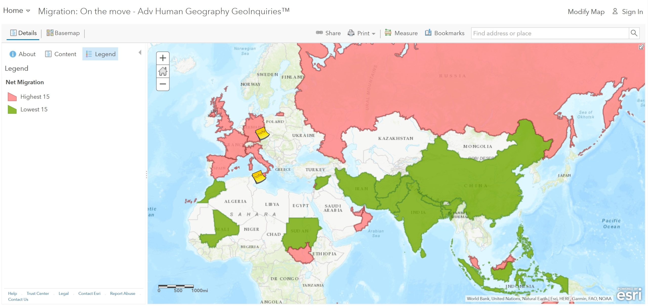
ASK: Where are people living and where are people going?
Step 1: Open up an Internet browser and go to the ArcGIS Online map, Migration: On the Move. Take a few moments to explore the map.
Step 2: Net migration is the difference in the number of people who migrate to and emigrate from a country. Use the map legend or a layer’s table data (sorted) to answer the following questions.
- Which regions had the lowest net migration?
- What push factors are causing the outflow of people?
- Which regions experience the highest net migration?
- What pull factors could be causing this in-migration of people?
ACQUIRE: Where are the most densely populated countries located?
Step 3: Click the Show Contents of Map button.
Step 4: Turn off the Net Migration layer and turn on the Asylum Seekers layer.
- Which regions had the most asylum seekers in 2014?
Step 5: Turn off the Asylum Seekers layer. Choose the Europe bookmark. Turn on the Schengen Treaty layer and view the legend.
Step 6: Read the Map Note located near Germany.
- How does the Schengen Treaty make the European Union a favorable destination for would-be migrations?
EXPLORE: Why does Italy experience the largest number of refugee arrivals by sea?
Step 7: Choose the Mediterranean bookmark, then open and read the Map Note near the southern tip of Italy.
- What is it about Italy’s site and situation that makes it one of the main entry points via water?
- How far is the mainland of Italy from North Africa?
Step 8: Choose the Italy Asylum bookmark, and then turn on the Asylum Seekers, Italy layer.
- In 2014, where were most of Italy’s asylum seekers from?
- Do any of the countries or origin surprise you, or not surprise you?
ANALYZE: Where is Lampedusa, and why it is Italy’s gateway to Europe?
Step 9: Choose the Lampedusa 1 bookmark, and change the basemap to Open Street Map.
- Which country owns the islands?
Step 10: Choose the Lampedusa 2 bookmark, and use the Measure tool to answer the questions below.
- How long is the island east to west?
- How long is it north to south?
Step 11: Change the basemap back to National Geographic, and then choose the Lampedusa 3 bookmark.
- How far is Lampedusa from Tunisia?
- How far is Europe from Africa?
ACT: What challenge does refugee migration to Lampedusa pose at different scales?
Step 12: Choose the Mediterranean bookmark.
- What challenges does the Mediterranean migration route pose to Lampedusa?
- What challenges does the Mediterranean migration route pose to the European Union and the International community?
Refugees and Internally Displaced Peoples
https://www.youtube.com/watch?v=SQVmx9CA-Uo
Do an Internet search and find one current example of refugees and one current example of internally displaced peoples. Compare and contrast these different groups. What similarities do these groups share? What are their primary differences? Also, consider how refugees and internally displaced people have changed the population characteristics of their current location. For example, have these factors affected birthrates or infant mortality rates? Write an explanation of your conclusions: support your conclusions with specific evidence from your research (statistics, maps, and other forms of data). Make sure to also site all of your sources! Too often on the Internet, we try to look for quick and easy information. But are you checking to make sure the data comes from reliable or primary sources?
